Signs for Albemarle’s Historical Marker program should be installed early next year
Published 8:41 am Wednesday, December 21, 2022
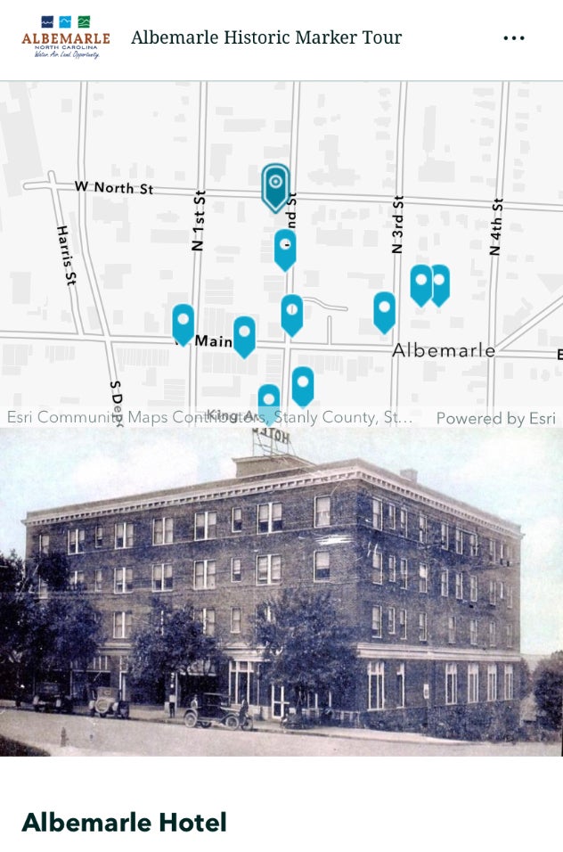
- The first batch of historical markers highlighting prominent Albemarle locations, like the old Albemarle Hotel, should be installed early next year.
|
Getting your Trinity Audio player ready...
|
The first batch of historical markers that will posted throughout Albemarle, highlighting notable locations throughout the city, should be installed early next year, according to Planning specialist Brittani McClendon, who presented a brief update about the program before City Council Monday night.
The city will purchase the new signs next month, McClendon said, and should hopefully have them installed by February.
The signs for the Historic Marker program should be installed early next year.
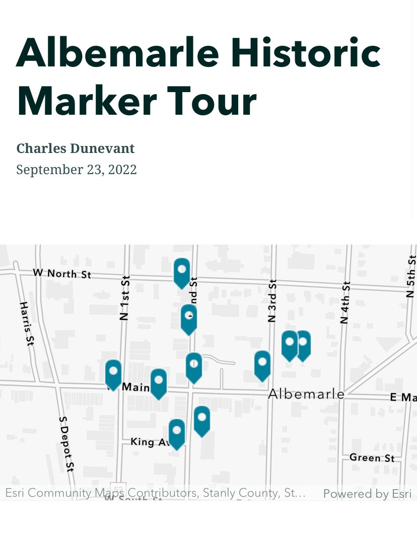
The city’s Planning staff has identified 10 locations as part of its first phase, including historical properties that are no longer around.
The locations for the first phase include:
- Starnes Jewelers, now known as Starnes Bramlett Jewelers, on West Main Street which has been a fixture in the community since 1898. The building also housed the old Opera House;
- The old Albemarle Hotel on North Second Street which is being renovated and will soon be turned into an upscale apartment complex;
- The former Alameda Theater on North Second Street across from City Hall;
- The Isaiah and Ellen Snuggs House, which has been around for almost 170 years, and the Freeman-Marks House, the oldest public building still standing in Albemarle, on North Third Street;
- The former Maralise Hotel, which was on West Main Street;
- Courthouse Park at the corner of Main and Second streets, which was the site of the first jail and second courthouse;
- Stanly County Public Library on East Main Street, which was the site of two former jails;
- Stanly County Courthouse on South Second Street, which was the former site of Freeman Hotel, Stagecoach Stop, Central Hotel and Bivens Cabinet Shop;
- Center Theater on West Main Street; and
- The former Ogden and Elizabeth King House on South Second Street.
The program, which is part of a joint collaboration between the city and the Stanly County Historical Society, was first approved by the council during its Aug. 1 meeting.
“With the addition of the locations, we are using the markers to digitally tell stories with GIS,” McClendon told Council, adding that the planning staff is producing a web-based story map. The markers will provide a short history of each location along with a QR code which will help the city track engagement.
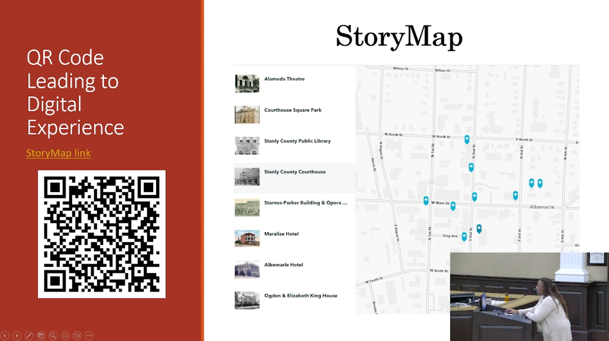
People can scan the QR code with their phones to learn more about the marker program.
“It’s an immersive experience to be had on your phone or the computer,” she said, noting the map will also be easy to update as needed.
The signs will be orange and 12-by-12-inches, thereby differentiating from the traditional 12-by-18-inch standard traffic signs, and will be affixed onto existing light poles (near each location) around the city.
The planning department has been working with the public works department to ensure the city has the necessary materials to hang the signs.
“The Historical Society was pleased to collaborate on this project with Planning and Development staff,” Historical Society President Kent Harkey told Council. He commended the city’s resident historian Lewis Bramlett, who worked to make sure the facts associated with each location were accurate.
In other news, the council:
- Approved rezoning 1.2 acres located off N.C. Highway 740 Bypass East at Woodhaven Drive from R-6/Urban Residential District to GHBD/General Highway Business District.
- Approved adopting amendments to Chapter 92 Zoning Regulations, Sections 8 Definitions and Section 102 GHBD.
About Chris Miller
Chris Miller has been with the SNAP since January 2019. He is a graduate of NC State and received his Master's in Journalism from the University of Maryland. He previously wrote for the Capital News Service in Annapolis, where many of his stories on immigration and culture were published in national papers via the AP wire.
 More by Chris